پەڕگە:Tehran Province location map (with labels).svg

Size of this PNG preview of this SVG file: ٨٠٠ لە ٤١٨ پیکسەڵ. ڕێزەلووشنەکانی تر: ٣٢٠ لە ١٦٧ پیکسەڵ | ٦٤٠ لە ٣٣٥ پیکسەڵ | ١٬٠٢٤ لە ٥٣٥ پیکسەڵ | ١٬٢٨٠ لە ٦٦٩ پیکسەڵ | ٢٬٥٦٠ لە ١٬٣٣٨ پیکسەڵ | ١٬٩٨٠ لە ١٬٠٣٥ پیکسەڵ.
پەڕگەی سەرەکی (پەڕگەی SVG، بە ناو ١٬٩٨٠ × ١٬٠٣٥ پیکسەڵ، قەبارەی پەڕگە: ٣٢٤ کیلۆبایت)
.svg)
کورتە
| وەسف |
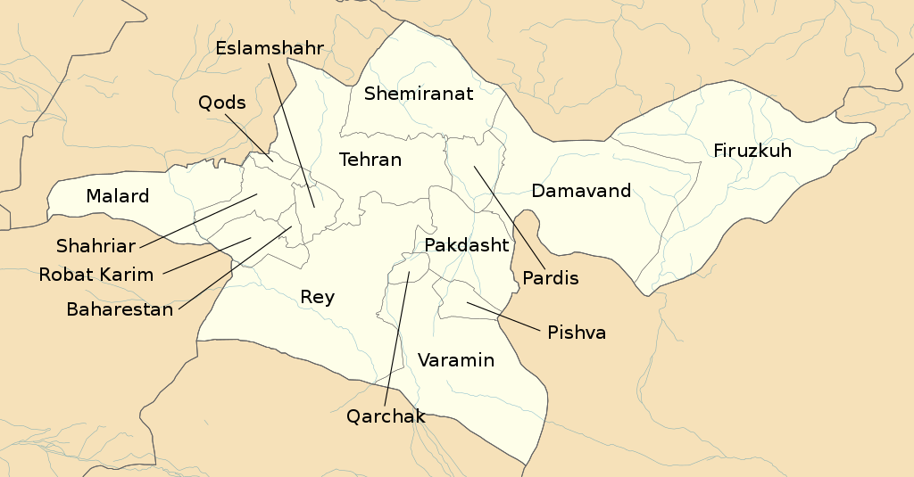
English: Location map of Tehran Province with labels, borders and streets from OpenStreetMap |
| ڕێکەوت | |
| سەرچاوە | بەرھەمی خۆم |
| بەرھەمھێنەر | Isochrone and OpenStreetMap contributors |
| SVG genesis |
مۆڵەتنامە
This file is licensed under the Creative Commons Attribution-Share Alike 4.0 International, 3.0 Unported, 2.5 Generic, 2.0 Generic and 1.0 Generic license.
- تۆ ئازادی:
- بۆ بڵاکردنەوە – بۆ کۆپی کردن، دابەشکردن و دەستبەدەست ناردنی
- بۆ تێکەڵکردنەوە – بۆ سازاندنی کارەکە
- بەم مەرجانەی خوارەوە:
- دانەپاڵ – پێویستە باوەڕی گونجاو بدەیت، بەستەرێک بۆ مۆڵەتەکە دابین بکەیت و ئاماژە بەوە بکەیت کە ئایا گۆڕانکاری کراوە یان نا. دەتوانیت بە هەر شێوەیەکی گونجاو ئەوە بکەیت، بەڵام بە شێوەیەک نا کە وا دەربکەوێت کە مۆڵەتدەر پشتگیری تۆ یان بەکارهێنانەکەت بکات.
- بڵاوکردنەوەی گونجاو – ئەگەر لەسەر بنەمای ئەم کارە تێکەڵ، گۆڕان، یان ساز بکەی، پێویستە بەشدارییەکانت بە هەمان مۆڵەت یان هاوشێوەی مۆڵەتی ئەسڵی دابەش بکەی.
| This work contains information from OpenStreetMap, which is made available under the Open Database License (ODbL).
The ODbL does not require any particular license for maps produced from ODbL data. Prior to 1 August 2020, map tiles produced by the OpenStreetMap Foundation were licensed under the CC-BY-SA-2.0 license. Maps produced by other people may be subject to other licences. |
مێژووی پەڕگە
کرتە بکە لەسەر یەکێک لە ڕێکەوت/کاتەکان بۆ بینینی پەڕگەکە بەو شێوەی لەو کاتەدا بووە.
| ڕێکەوت/کات | ھێما | ئەندازە | بەکارھێنەر | تێبینی | |
|---|---|---|---|---|---|
| هەنووکە | ١٣:٠٣، ٢٦ی ئابی ٢٠٢١ | | ١٬٩٨٠ لە ١٬٠٣٥ (٣٢٤ کیلۆبایت) | Isochrone | Reverted to version as of 15:29, 20 August 2021 (UTC) |
| ١٣:٠١، ٢٦ی ئابی ٢٠٢١ |  | ١٬٩٨٠ لە ١٬٠٣٥ (٣٤٠ کیلۆبایت) | Isochrone | File uploaded using svgtranslate tool (https://svgtranslate.toolforge.org/). Added translation for fa. | |
| ١٢:٥٨، ٢٦ی ئابی ٢٠٢١ |  | ١٬٩٨٠ لە ١٬٠٣٥ (٣٢٤ کیلۆبایت) | Isochrone | Reverted to version as of 15:29, 20 August 2021 (UTC) | |
| ١٢:٥٦، ٢٦ی ئابی ٢٠٢١ |  | ١٬٩٨٠ لە ١٬٠٣٥ (٣٣٣ کیلۆبایت) | Isochrone | File uploaded using svgtranslate tool (https://svgtranslate.toolforge.org/). Added translation for en. | |
| ١٥:٢٩، ٢٠ی ئابی ٢٠٢١ |  | ١٬٩٨٠ لە ١٬٠٣٥ (٣٢٤ کیلۆبایت) | Isochrone | =={{int:filedesc}}== {{Information |description={{en|Location map of Tehran Province with labels, borders and streets from OpenStreetMap}} |date=20 August 2021 |source={{own work}} |author={{u|Berrely}} and OpenStreetMap contributors |other fields={{Igen|ArcGIS|+|s=m}} }} =={{int:license-header}}== {{cc-by-sa-all}} {{ODbL OpenStreetMap}} Category:Maps by Berrely Category:Maps of Tehran Province |
بەکارھێنانی پەڕگە
ئەم پەڕەیە ئەم پەڕگەیە بەکار دەھێنێت:
بەکارھێنانی سەرانسەریی پەڕگە
ئەم ویکیانەی دیکەی خوارەوەش ئەم پەڕگە بەکاردێنن:
- بەکارھێنان لە en.wikipedia.org
- بەکارھێنان لە ml.wikipedia.org
- بەکارھێنان لە ur.wikipedia.org
.svg)