پەڕگە:Saint-Barthélemy collectivity location map with quartiers.svg

Size of this PNG preview of this SVG file: ٨٠٠ لە ٥٢٦ پیکسەڵ. ڕێزەلووشنەکانی تر: ٣٢٠ لە ٢١٠ پیکسەڵ | ٦٤٠ لە ٤٢٠ پیکسەڵ | ١٬٠٢٤ لە ٦٧٣ پیکسەڵ | ١٬٢٨٠ لە ٨٤١ پیکسەڵ | ٢٬٥٦٠ لە ١٬٦٨٢ پیکسەڵ | ١٬١٧٥ لە ٧٧٢ پیکسەڵ.
پەڕگەی سەرەکی (پەڕگەی SVG، بە ناو ١٬١٧٥ × ٧٧٢ پیکسەڵ، قەبارەی پەڕگە: ١٣٥ کیلۆبایت)
کورتە
| Camera location | | View this and other nearby images on: OpenStreetMap |
|---|
| وەسف |
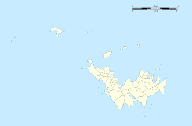
English: Blank administrative map of the overseas collectivity of Saint Barthélemy, France, with Quartiers boundaries, for geo-location purpose.
Français : Carte administrative vierge de la collectivité d'outre-mer de Saint-Barthélemy, France, avec limites des quartiers, destinée à la géolocalisation. Estimated scales: 1:200,000 (precision: 50 m)
Geographic limits of the map:
|
||
| ڕێکەوت | |||
| سەرچاوە |
بەرھەمی خۆم
|
||
| بەرھەمھێنەر | Eric Gaba (Sting - fr:Sting) | ||
| ڕێپێدان (بەکارھێنانەوەی ئەم پەڕگەیە) |
|
||
| وەشانەکانی تر |
|


مۆڵەتنامە
Eric Gaba, Wikimedia Commons user Sting، ھەڵگری مافی لەبەرگرتنەوەی ئەم بەرھەمە، لەژێر ئەم مۆڵەتنامەیانەدا بڵاوی دەکاتەوە:
ئەم پەڕگەیە لە ژێر مۆڵەتنامەی
Creative Commons Attribution-Share Alike 3.0 Unported دایە.
دانەپاڵ: Eric Gaba, Wikimedia Commons user Sting
- تۆ ئازادی:
- بۆ بڵاکردنەوە – بۆ کۆپی کردن، دابەشکردن و دەستبەدەست ناردنی
- بۆ تێکەڵکردنەوە – بۆ سازاندنی کارەکە
- بەم مەرجانەی خوارەوە:
- دانەپاڵ – پێویستە باوەڕی گونجاو بدەیت، بەستەرێک بۆ مۆڵەتەکە دابین بکەیت و ئاماژە بەوە بکەیت کە ئایا گۆڕانکاری کراوە یان نا. دەتوانیت بە هەر شێوەیەکی گونجاو ئەوە بکەیت، بەڵام بە شێوەیەک نا کە وا دەربکەوێت کە مۆڵەتدەر پشتگیری تۆ یان بەکارهێنانەکەت بکات.
- بڵاوکردنەوەی گونجاو – ئەگەر لەسەر بنەمای ئەم کارە تێکەڵ، گۆڕان، یان ساز بکەی، پێویستە بەشدارییەکانت بە هەمان مۆڵەت یان هاوشێوەی مۆڵەتی ئەسڵی دابەش بکەی.

|
ڕێگەدراوە بە لەبەرگرتنەوە، دابەشکردن ھەروەھا/یان سازاندنی ئەم بەڵگەنامەیە لەژێر مەرجی مۆڵەتی GNU بۆ بەڵگەنامەی ئازاد، وەشانی ١.٢ یان ھەر وەشانێکی تری دواتر کە بڵاوکراوەتەوە لەلایەن دامەزراوەی بەرنامەی ئازاد، بەبێ ھیچ بەشێکی جیاواز، بەبێ نووسین لەسەر بەرگی پێشەوە و دواوەی. وێنەیەک لەمۆڵەتەکە لە بەشێکدا ھەیە کە ناوی مۆڵەتی GNU بۆ بەڵگەنامەی ئازادە. |
دەتوانی مۆڵەتنامەی دڵخوازت ھەڵبژێریت.
مێژووی پەڕگە
کرتە بکە لەسەر یەکێک لە ڕێکەوت/کاتەکان بۆ بینینی پەڕگەکە بەو شێوەی لەو کاتەدا بووە.
| ڕێکەوت/کات | ھێما | ئەندازە | بەکارھێنەر | تێبینی | |
|---|---|---|---|---|---|
| هەنووکە | ٠٢:٠١، ٢٦ی شوباتی ٢٠١٠ | | ١٬١٧٥ لە ٧٧٢ (١٣٥ کیلۆبایت) | Sting | == {{int:filedesc}} == {{Location|17|55|30|N|62|51|45|W|scale:50000}} <br/> {{Information |Description={{en|Blank administrative map of the overseas collectivity of Saint Barthélemy, [[:en:France|Fr |
بەکارھێنانی پەڕگە
ئەم پەڕەیە ئەم پەڕگەیە بەکار دەھێنێت:
بەکارھێنانی سەرانسەریی پەڕگە
ئەم ویکیانەی دیکەی خوارەوەش ئەم پەڕگە بەکاردێنن:
- بەکارھێنان لە ar.wikipedia.org
- بەکارھێنان لە ast.wikipedia.org
- بەکارھێنان لە bg.wikipedia.org
- بەکارھێنان لە bn.wikipedia.org
- بەکارھێنان لە bs.wikipedia.org
- بەکارھێنان لە ceb.wikipedia.org
- Plantilya:Location map Saint Barthélemy
- West Channel
- South Channel
- Goat Island
- Sugarloaf
- Southeast Channel
- Canal du Sud
- Baie de Saint-Jean
- Saint Barthelemy
- Saint Bartholomew Island
- Saint-Barthélemy (pagklaro)
- Roches Rouges
- Roques (pagklaro)
- Île de la Pointe
- Le Pain de Sucre
- Canal de l'Ouest
- Pointe Nègre
- Pointe Negre
- Pointe Lézarde
- Les Saintes
- Les Islettes (pagklaro)
- Les Baleines
- Le Carénage
- La Tortue
- Île Tortue
- La Baleine (pagklaro)
- Roche Baleine
- Gustaf
- Grande Pointe
- Île Frégate
- Ile Fregate
- Îlet Frégate
- Fourche
- Pointe Colombier
- Ile Coco
- Barrel of Beef
- Le Boeuf
- Baie des Flamands
- Morne du Vitet
- Pointe à Toigny
- Île Toc Vers
- Roche Table
بینینی بەکارھێنانی گشتی زیاتری ئەم پەڕگەیە.