پەڕگە:Netherlands location map 1944.svg

Size of this PNG preview of this SVG file: ٥٣٢ لە ٦٠٠ پیکسەڵ. ڕێزەلووشنەکانی تر: ٢١٣ لە ٢٤٠ پیکسەڵ | ٤٢٦ لە ٤٨٠ پیکسەڵ | ٦٨١ لە ٧٦٨ پیکسەڵ | ٩٠٨ لە ١٬٠٢٤ پیکسەڵ | ١٬٨١٧ لە ٢٬٠٤٨ پیکسەڵ | ٨٨٨ لە ١٬٠٠١ پیکسەڵ.
پەڕگەی سەرەکی (پەڕگەی SVG، بە ناو ٨٨٨ × ١٬٠٠١ پیکسەڵ، قەبارەی پەڕگە: ١٫٣٢ مێگابایت)
کورتە
| وەسف |
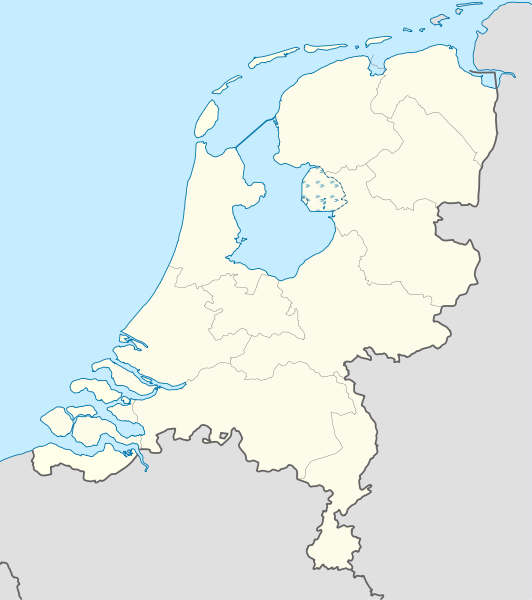
Deutsch: Positionskarte der Niederlande für das Jahr 1944
Quadratische Plattkarte, N-S-Streckung 160 %. Geographische Begrenzung der Karte:
English: Location map of the Netherlands as of 1944
Equirectangular projection, N/S stretching 160 %. Geographic limits of the map:
|
| ڕێکەوت | |
| سەرچاوە |
بەرھەمی خۆم This W3C-unspecified vector image was created with Adobe Illustrator. This vector image includes elements that have been taken or adapted from this file: |
| بەرھەمھێنەر | Lencer |

|
This map has been made or improved in the German Kartenwerkstatt (Map Lab). You can propose maps to improve as well.
|
مۆڵەتنامە
من، ھەڵگری مافی لەبەرگرتنەوەی ئەم بەرھەمە، لەژێر ئەم مۆڵەتنامەیانەدا بڵاوی دەکەمەوە:

|
ڕێگەدراوە بە لەبەرگرتنەوە، دابەشکردن ھەروەھا/یان سازاندنی ئەم بەڵگەنامەیە لەژێر مەرجی مۆڵەتی GNU بۆ بەڵگەنامەی ئازاد، وەشانی ١.٢ یان ھەر وەشانێکی تری دواتر کە بڵاوکراوەتەوە لەلایەن دامەزراوەی بەرنامەی ئازاد، بەبێ ھیچ بەشێکی جیاواز، بەبێ نووسین لەسەر بەرگی پێشەوە و دواوەی. وێنەیەک لەمۆڵەتەکە لە بەشێکدا ھەیە کە ناوی مۆڵەتی GNU بۆ بەڵگەنامەی ئازادە. |
ئەم پەڕگەیە لە ژێر مۆڵەتنامەی
Creative Commons Attribution-Share Alike 3.0 Unported دایە.
- تۆ ئازادی:
- بۆ بڵاکردنەوە – بۆ کۆپی کردن، دابەشکردن و دەستبەدەست ناردنی
- بۆ تێکەڵکردنەوە – بۆ سازاندنی کارەکە
- بەم مەرجانەی خوارەوە:
- دانەپاڵ – پێویستە باوەڕی گونجاو بدەیت، بەستەرێک بۆ مۆڵەتەکە دابین بکەیت و ئاماژە بەوە بکەیت کە ئایا گۆڕانکاری کراوە یان نا. دەتوانیت بە هەر شێوەیەکی گونجاو ئەوە بکەیت، بەڵام بە شێوەیەک نا کە وا دەربکەوێت کە مۆڵەتدەر پشتگیری تۆ یان بەکارهێنانەکەت بکات.
- بڵاوکردنەوەی گونجاو – ئەگەر لەسەر بنەمای ئەم کارە تێکەڵ، گۆڕان، یان ساز بکەی، پێویستە بەشدارییەکانت بە هەمان مۆڵەت یان هاوشێوەی مۆڵەتی ئەسڵی دابەش بکەی.
دەتوانی مۆڵەتنامەی دڵخوازت ھەڵبژێریت.
مێژووی پەڕگە
کرتە بکە لەسەر یەکێک لە ڕێکەوت/کاتەکان بۆ بینینی پەڕگەکە بەو شێوەی لەو کاتەدا بووە.
| ڕێکەوت/کات | ھێما | ئەندازە | بەکارھێنەر | تێبینی | |
|---|---|---|---|---|---|
| هەنووکە | ٠٩:٣٤، ٩ی تەممووزی ٢٠١١ | | ٨٨٨ لە ١٬٠٠١ (١٫٣٢ مێگابایت) | TUBS | Lauwerszee was keeen maar, Europoort nok niet; Sloe was niet afsluiten, Neeltje Jans en de eilanden bij Goeree es Schouwen was nog niet, Sint Philipsland was en eiland |
| ١٧:٥٢، ٦ی تەممووزی ٢٠١١ |  | ٨٨٨ لە ١٬٠٠١ (٢٨١ کیلۆبایت) | TUBS | corr | |
| ١٤:٠٤، ٦ی تەممووزی ٢٠١١ |  | ٨٨٨ لە ١٬٠٠١ (٢٨١ کیلۆبایت) | TUBS | corr | |
| ١٣:٥٩، ٦ی تەممووزی ٢٠١١ |  | ٨٨٨ لە ١٬٠٠١ (٢٨١ کیلۆبایت) | TUBS | == {{int:filedesc}} == {{Information |Description= {{de|Positionskarte der Niederlande für das Jahr 1944}} Quadratische Plattkarte, N-S-Streckung 160 %. Geographische Begrenzung der Karte: * N: 53.7° N * S: 50.6° N * W: 3.1° |
بەکارھێنانی پەڕگە
ئەم پەڕەیە ئەم پەڕگەیە بەکار دەھێنێت:
بەکارھێنانی سەرانسەریی پەڕگە
ئەم ویکیانەی دیکەی خوارەوەش ئەم پەڕگە بەکاردێنن:
- بەکارھێنان لە als.wikipedia.org
- بەکارھێنان لە ar.wikipedia.org
- بەکارھێنان لە ceb.wikipedia.org
- بەکارھێنان لە de.wikipedia.org
- بەکارھێنان لە es.wikipedia.org
- بەکارھێنان لە frr.wikipedia.org
- بەکارھێنان لە ka.wikipedia.org
- بەکارھێنان لە mk.wikipedia.org
- بەکارھێنان لە ml.wikipedia.org
- بەکارھێنان لە mn.wikipedia.org
- بەکارھێنان لە pl.wikipedia.org
- بەکارھێنان لە pl.wikibooks.org
- بەکارھێنان لە sco.wikipedia.org
- بەکارھێنان لە sl.wikipedia.org
- بەکارھێنان لە sq.wikipedia.org
- بەکارھێنان لە tg.wikipedia.org
- بەکارھێنان لە war.wikipedia.org
- بەکارھێنان لە xmf.wikipedia.org
- بەکارھێنان لە zh.wikipedia.org