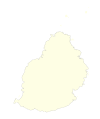
پەڕگە:Mauritius location map.svg

Size of this PNG preview of this SVG file: ٤٤٠ لە ٦٠٠ پیکسەڵ. ڕێزەلووشنەکانی تر: ١٧٦ لە ٢٤٠ پیکسەڵ | ٣٥٢ لە ٤٨٠ پیکسەڵ | ٥٦٣ لە ٧٦٨ پیکسەڵ | ٧٥١ لە ١٬٠٢٤ پیکسەڵ | ١٬٥٠٣ لە ٢٬٠٤٨ پیکسەڵ | ١٬٤٠٠ لە ١٬٩٠٨ پیکسەڵ.
پەڕگەی سەرەکی (پەڕگەی SVG، بە ناو ١٬٤٠٠ × ١٬٩٠٨ پیکسەڵ، قەبارەی پەڕگە: ١٣٦ کیلۆبایت)
مێژووی پەڕگە
کرتە بکە لەسەر یەکێک لە ڕێکەوت/کاتەکان بۆ بینینی پەڕگەکە بەو شێوەی لەو کاتەدا بووە.
| ڕێکەوت/کات | ھێما | ئەندازە | بەکارھێنەر | تێبینی | |
|---|---|---|---|---|---|
| هەنووکە | ١٨:١٤، ٥ی تشرینی یەکەمی ٢٠١١ |  | ١٬٤٠٠ لە ١٬٩٠٨ (١٣٦ کیلۆبایت) | Yash400 | Reverted to version as of 14:15, 9 December 2010 |
| ١٨:١٢، ٥ی تشرینی یەکەمی ٢٠١١ |  | ١٬٤٠٠ لە ١٬٩٠٨ (١٣٦ کیلۆبایت) | Yash400 | Reverted to version as of 14:15, 9 December 2010 | |
| ١٨:١١، ٥ی تشرینی یەکەمی ٢٠١١ |  | ١٬٤٠٠ لە ١٬٩٠٨ (١٣٦ کیلۆبایت) | Yash400 | Reverted to version as of 14:15, 9 December 2010 | |
| ١٨:١١، ٥ی تشرینی یەکەمی ٢٠١١ |  | ١٬٤٠٠ لە ١٬٩٠٨ (٤١ کیلۆبایت) | Yash400 | Reverted to version as of 10:10, 2 October 2011 | |
| ١٨:١٦، ٢ی تشرینی یەکەمی ٢٠١١ |  | ١٬٤٠٠ لە ١٬٩٠٨ (٣٩ کیلۆبایت) | Yash400 | change colour | |
| ١٠:١٠، ٢ی تشرینی یەکەمی ٢٠١١ |  | ١٬٤٠٠ لە ١٬٩٠٨ (٤١ کیلۆبایت) | Yash400 | exact size needed | |
| ٠٩:٥٤، ٢ی تشرینی یەکەمی ٢٠١١ |  | ١٬٨١٠ لە ٢٬١٦٠ (١٫٣ مێگابایت) | Yash400 | update size of map | |
| ٠٩:٤٢، ٢ی تشرینی یەکەمی ٢٠١١ |  | ١٬٨١٠ لە ٢٬١٦٠ (١٫٣ مێگابایت) | Yash400 | more islets added | |
| ١٤:١٥، ٩ی کانوونی یەکەمی ٢٠١٠ |  | ١٬٤٠٠ لە ١٬٩٠٨ (١٣٦ کیلۆبایت) | Uwe Dedering | coastline completly new | |
| ٢١:٥٦، ١٦ی شوباتی ٢٠١٠ |  | ١٬٤٠٠ لە ١٬٩٠٨ (٥١ کیلۆبایت) | Uwe Dedering | {{Information |Description={{de|Location map of Mauritius Equirectangular projection. Stretched by 106.0%. Geographic limits of the map: * N: -19.7° N * S: -20.6° N * W: 57.21° E * E: 57.91° E Made with Natural Earth. Free vector and raster map data @ |
بەکارھێنانی پەڕگە
ئەم پەڕەیە ئەم پەڕگەیە بەکار دەھێنێت:
بەکارھێنانی سەرانسەریی پەڕگە
ئەم ویکیانەی دیکەی خوارەوەش ئەم پەڕگە بەکاردێنن:
- بەکارھێنان لە af.wikipedia.org
- بەکارھێنان لە am.wikipedia.org
- بەکارھێنان لە an.wikipedia.org
- بەکارھێنان لە ar.wikipedia.org
- بەکارھێنان لە ast.wikipedia.org
- بەکارھێنان لە az.wikipedia.org
- بەکارھێنان لە ba.wikipedia.org
- بەکارھێنان لە be-tarask.wikipedia.org
- بەکارھێنان لە be.wikipedia.org
- بەکارھێنان لە bg.wikipedia.org
- بەکارھێنان لە bn.wikipedia.org
- بەکارھێنان لە bs.wikipedia.org
- بەکارھێنان لە ca.wikipedia.org
- بەکارھێنان لە ceb.wikipedia.org
- Plantilya:Location map Mauritius
- Sandy Island
- Sandy Islet
- The Narrows
- Bird Island
- Bird Islet
- Rocky Point
- Cat Island
- Devils Point
- Sand Point
- The Bluff
- Diamond Point
- Combo
- Nelson
- Noire
- West Peak
- Whale Rock
- Albion
- Oliva (pagklaro)
- Rodriguez
- East Peak
- Flat Island
- Saint-André (pagklaro)
- Roche Baleine
- Grande Pointe
- Ile Coco
بینینی بەکارھێنانی گشتی زیاتری ئەم پەڕگەیە.

