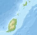
پەڕگە:Grenada relief location map.jpg

قەبارەی ئەم پێشبینینە: ٦٣٤ لە ٥٩٩ پیکسەڵ. ڕێزەلووشنەکانی تر: ٢٥٤ لە ٢٤٠ پیکسەڵ | ٥٠٨ لە ٤٨٠ پیکسەڵ | ٨١٣ لە ٧٦٨ پیکسەڵ | ١٬٠٨٤ لە ١٬٠٢٤ پیکسەڵ | ١٬٤٣٥ لە ١٬٣٥٦ پیکسەڵ.
پەڕگەی سەرەکی (١٬٤٣٥ × ١٬٣٥٦ پیکسڵ، قەبارەی پەڕگە: ٤٢٤ کیلۆبایت، جۆری ئێم ئای ئێم ئی: image/jpeg)
مێژووی پەڕگە
کرتە بکە لەسەر یەکێک لە ڕێکەوت/کاتەکان بۆ بینینی پەڕگەکە بەو شێوەی لەو کاتەدا بووە.
| ڕێکەوت/کات | ھێما | ئەندازە | بەکارھێنەر | تێبینی | |
|---|---|---|---|---|---|
| هەنووکە | ١١:١٤، ٢٤ی کانوونی یەکەمی ٢٠١٠ |  | ١٬٤٣٥ لە ١٬٣٥٦ (٤٢٤ کیلۆبایت) | Uwe Dedering | initial upload |
بەکارھێنانی پەڕگە
ئەم پەڕەیە ئەم پەڕگەیە بەکار دەھێنێت:
بەکارھێنانی سەرانسەریی پەڕگە
ئەم ویکیانەی دیکەی خوارەوەش ئەم پەڕگە بەکاردێنن:
- بەکارھێنان لە ar.wikipedia.org
- بەکارھێنان لە ast.wikipedia.org
- بەکارھێنان لە ba.wikipedia.org
- بەکارھێنان لە bg.wikipedia.org
- بەکارھێنان لە bn.wikipedia.org
- بەکارھێنان لە bs.wikipedia.org
- بەکارھێنان لە ceb.wikipedia.org
- بەکارھێنان لە ce.wikipedia.org
- بەکارھێنان لە cs.wikipedia.org
- بەکارھێنان لە da.wikipedia.org
- بەکارھێنان لە de.wikipedia.org
- Grenada
- Carriacou
- Mount Saint Catherine
- Petite Martinique
- Vorlage:Positionskarte Grenada
- Wikipedia:Kartenwerkstatt/Positionskarten/Nordamerika
- Benutzer:Uwe Dedering
- Ronde Island
- Lake Antoine
- Grand Etang Lake
- Caille Island
- Diamond Island (Grenada)
- Large Island (Grenada)
- Frigate Island (Carriacou)
- White Island (Grenada)
- Saline Island
- Cassada Rocks
- Mushroom Island (Grenada)
- Sandy Island (Carriacou)
- Mabouya Island
- Sister Rocks (Grenada)
- Bird Island (Grenada)
- Sugarloaf (Grenada)
- Green Island (Grenada)
- Sandy Island (Grenada)
- London Bridge (Grenadinen)
- Bonaparte Rocks
- Rose Rock (Grenada)
- Les Tantes
- Palmiste Lake
- Concord Falls
- Annendale Falls
- Seven Sisters Waterfalls
- St. Margaret Falls
بینینی بەکارھێنانی گشتی زیاتری ئەم پەڕگەیە.

