پەڕگە:VictoriaIslandMap.png
رەزۆلوشنی سەرتر لەمە لە بەردەست دا نیە.
VictoriaIslandMap.png (٥٠٤ × ٥٤٠ پیکسڵ، قەبارەی پەڕگە: ٢٧ کیلۆبایت، جۆری ئێم ئای ئێم ئی: image/png)
کورتە
| وەسف |
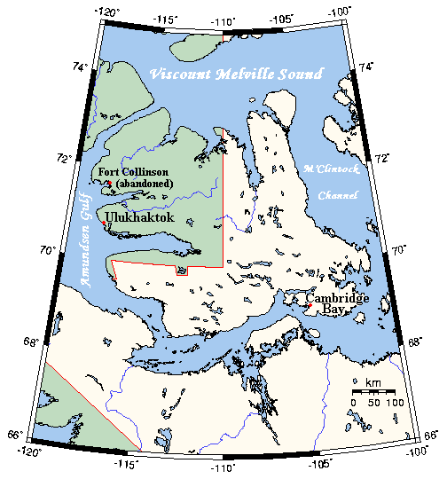
English: A map Victoria Island, Canada |
| ڕێکەوت | not specified |
| سەرچاوە | This map's source is here, with the uploader's modifications, and the GMT homepage says that the tools are released under the GNU General Public License |
| بەرھەمھێنەر | Kelisi at en.wikipedia |
مۆڵەتنامە
Kelisi from en.wikipedia.org، ھەڵگری مافی لەبەرگرتنەوەی ئەم بەرھەمە، لەژێر ئەم مۆڵەتنامەیەدا بڵاوی دەکاتەوە:
| ئەم پەڕگەیە لە ژێر مۆڵەتنامەی
Creative Commons Attribution-Share Alike 3.0 Unported دایە. Subject to disclaimers. |
||
| دانەپاڵ: Kelisi from en.wikipedia.org | ||
| ||
| This licensing tag was added to this file as part of the GFDL licensing update. |

|
ڕێگەدراوە بە لەبەرگرتنەوە، دابەشکردن ھەروەھا/یان سازاندنی ئەم بەڵگەنامەیە لەژێر مەرجی مۆڵەتی GNU بۆ بەڵگەنامەی ئازاد، وەشانی ١.٢ یان ھەر وەشانێکی تری دواتر کە بڵاوکراوەتەوە لەلایەن دامەزراوەی بەرنامەی ئازاد، بەبێ ھیچ بەشێکی جیاواز، بەبێ نووسین لەسەر بەرگی پێشەوە و دواوەی. وێنەیەک لەمۆڵەتەکە لە بەشێکدا ھەیە کە ناوی مۆڵەتی GNU بۆ بەڵگەنامەی ئازادە. Subject to disclaimers. |
Original upload log
All following user names refer to en.wikipedia.
- 2006-03-25 03:16 Kelisi 504×540×8 (21 KB) (A map of Victoria Island in the Northwest Territories and Nunavut. This map's source is [http://www.aquarius.geomar.de/omc/make_map.html here], with the uploader's modifications, and the [http://gmt.soest.hawaii.edu/ GMT homepage] says that the tools are )
مێژووی پەڕگە
کرتە بکە لەسەر یەکێک لە ڕێکەوت/کاتەکان بۆ بینینی پەڕگەکە بەو شێوەی لەو کاتەدا بووە.
| ڕێکەوت/کات | ھێما | ئەندازە | بەکارھێنەر | تێبینی | |
|---|---|---|---|---|---|
| هەنووکە | ٠١:٥٣، ٣١ی کانوونی دووەمی ٢٠٢١ | | ٥٠٤ لە ٥٤٠ (٢٧ کیلۆبایت) | Kelisi | Oops! That was silly. Sorry, I'll try again.......... |
| ٠١:٥٠، ٣١ی کانوونی دووەمی ٢٠٢١ |  | ٥٠٤ لە ٥٤٠ (٢٧ کیلۆبایت) | Kelisi | Inhabited hamlets' names have been rendered in bigger type (Fort Collinson has been left smaller), and the local name Ulukhaktok has replaced the former, English name Holman, since the article about the place now has that title. | |
| ١١:٣٢، ١٣ی ئابی ٢٠٠٨ |  | ٥٠٤ لە ٥٤٠ (٢١ کیلۆبایت) | Telim tor | == Information == {{Information |Description={{en|A map Victoria Island, Canada}} |Source=This map's source is [http://www.aquarius.ifm-geomar.de/ here], with the uploader's modifications, and the [http://gmt.soest.hawaii.edu/ GMT homepage] says that the |
بەکارھێنانی پەڕگە
ئەم پەڕەیە ئەم پەڕگەیە بەکار دەھێنێت:
بەکارھێنانی سەرانسەریی پەڕگە
ئەم ویکیانەی دیکەی خوارەوەش ئەم پەڕگە بەکاردێنن:
- بەکارھێنان لە af.wikipedia.org
- بەکارھێنان لە bg.wikipedia.org
- بەکارھێنان لە bs.wikipedia.org
- بەکارھێنان لە ca.wikipedia.org
- بەکارھێنان لە da.wikipedia.org
- بەکارھێنان لە en.wikipedia.org
- بەکارھێنان لە eo.wikipedia.org
- بەکارھێنان لە es.wikipedia.org
- بەکارھێنان لە fa.wikipedia.org
- بەکارھێنان لە gl.wikipedia.org
- بەکارھێنان لە hu.wikipedia.org
- بەکارھێنان لە ilo.wikipedia.org
- بەکارھێنان لە nn.wikipedia.org
- بەکارھێنان لە no.wikipedia.org
- بەکارھێنان لە pl.wikipedia.org
- بەکارھێنان لە ro.wikipedia.org
- بەکارھێنان لە th.wikipedia.org
- بەکارھێنان لە tt.wikipedia.org
- بەکارھێنان لە www.wikidata.org
- بەکارھێنان لە zh.wikipedia.org