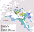
پەڕگە:OttomanEmpireIn1683.png

قەبارەی ئەم پێشبینینە: ٦٣٧ لە ٥٩٩ پیکسەڵ. ڕێزەلووشنەکانی تر: ٢٥٥ لە ٢٤٠ پیکسەڵ | ٥١٠ لە ٤٨٠ پیکسەڵ | ٨١٦ لە ٧٦٨ پیکسەڵ | ١٬٠٨٨ لە ١٬٠٢٤ پیکسەڵ | ١٬٩٦٦ لە ١٬٨٥٠ پیکسەڵ.
پەڕگەی سەرەکی (١٬٩٦٦ × ١٬٨٥٠ پیکسڵ، قەبارەی پەڕگە: ٢٩٨ کیلۆبایت، جۆری ئێم ئای ئێم ئی: image/png)
مێژووی پەڕگە
کرتە بکە لەسەر یەکێک لە ڕێکەوت/کاتەکان بۆ بینینی پەڕگەکە بەو شێوەی لەو کاتەدا بووە.
| ڕێکەوت/کات | ھێما | ئەندازە | بەکارھێنەر | تێبینی | |
|---|---|---|---|---|---|
| هەنووکە | ١٧:٣٥، ١٧ی ئەیلوولی ٢٠٢٠ |  | ١٬٩٦٦ لە ١٬٨٥٠ (٢٩٨ کیلۆبایت) | Visnelma | Adjusted eastern and balkan borders, also vassals are added. |
| ٢٢:٣٦، ١٦ی ئەیلوولی ٢٠٢٠ |  | ١٬٩٦٦ لە ١٬٨٥٠ (٢٩٦ کیلۆبایت) | Visnelma | African coast of Red Sea was painted purple by mistake, I have corrected that. Also Georgia was an Ottoman vassal. I have added that. | |
| ٢١:٤٢، ١٦ی ئەیلوولی ٢٠٢٠ |  | ١٬٩٦٦ لە ١٬٨٥٠ (٢٩٦ کیلۆبایت) | Visnelma | Athens and Morea was conquered during the reign of Mehmed II. Odessa and Moldova was conquered during the reign of Beyazid II. Hicaz and Yemen was conquered by Selim I. The region that connected Ottoman mainland and Crimea was conquered during the reign of Suleiman the Magnificent as well as Georgia. The territory on Persian gulf which is extension of Iraq was conquered during the reign of Suleiman, Ottomans never conquered Circassia. Furthermore Podolia was conquered during the 17th century,... | |
| ١٧:٤٩، ٣١ی ئایاری ٢٠١٤ |  | ١٬٩٦٦ لە ١٬٨٥٠ (٣٦٩ کیلۆبایت) | Spiridon Ion Cepleanu | New rectification since H.-E. Stier (dir.): « Westermann Grosser Atlas zur Weltgeschichte », 1985, ISBN 3-14-100919-8, pp. 96, 97, 103, 112 (because the accuracy is disputed) but with a better appearence I hope. | |
| ١٧:٥٨، ٦ی ئازاری ٢٠١٣ |  | ١٬٩٦٦ لە ١٬٨٥٠ (٣٣٩ کیلۆبایت) | DragonTiger23 | Reverted to version as of 23:11, 10 December 2010 Returned the map to its original appearance. | |
| ١٩:٤٧، ٤ی ئازاری ٢٠١٢ |  | ٦٣٧ لە ٥٩٩ (١٧٢ کیلۆبایت) | Spiridon Ion Cepleanu | Little changes since Hans-Erich Stier (ed.), Grosser Atlas zur Weltgeschichte, Westermann 1895, ISBN 3-14-10 0919-8, pp. 103, 103 & 112. | |
| ٢٣:١١، ١٠ی کانوونی یەکەمی ٢٠١٠ |  | ١٬٩٦٦ لە ١٬٨٥٠ (٣٣٩ کیلۆبایت) | Lambiam | Scale indicator more up to actual scale | |
| ١٨:٥٣، ١٦ی تشرینی دووەمی ٢٠١٠ |  | ١٬٩٦٦ لە ١٬٨٥٠ (٣٦٧ کیلۆبایت) | Hamelin de Guettelet | {{Information |Description= Rhodes et autres îles ne sont prises aux Hospitaliers que le 1 janvier 1523 |Source={{own}} |Date=16 novembre 2010 |Author=Hamelin de Guettelet |Permission= |other_versions= }} | |
| ١٠:٤٠، ١ی نیسانی ٢٠١٠ |  | ١٬٩٦٦ لە ١٬٨٥٠ (٣٢٧ کیلۆبایت) | Nedim Ardoğa | Reverted to version as of 07:37, 10 March 2010 | |
| ١٢:١١، ٣١ی ئازاری ٢٠١٠ |  | ٦٣٧ لە ٥٩٩ (١٦٥ کیلۆبایت) | Bahramm 2 | Reverted to version as of 14:12, 1 March 2010 |
بەکارھێنانی پەڕگە
ئەم پەڕەی 4ە ئەم پەڕگەیە بەکار دەھێنێت:
بەکارھێنانی سەرانسەریی پەڕگە
ئەم ویکیانەی دیکەی خوارەوەش ئەم پەڕگە بەکاردێنن:
- بەکارھێنان لە af.wikipedia.org
- بەکارھێنان لە am.wikipedia.org
- بەکارھێنان لە ar.wikipedia.org
- بەکارھێنان لە ast.wikipedia.org
- بەکارھێنان لە av.wikipedia.org
- بەکارھێنان لە az.wikipedia.org
- بەکارھێنان لە ba.wikipedia.org
- بەکارھێنان لە be.wikipedia.org
- بەکارھێنان لە bg.wikipedia.org
- بەکارھێنان لە bn.wikipedia.org
- بەکارھێنان لە bs.wikipedia.org
- بەکارھێنان لە bxr.wikipedia.org
- بەکارھێنان لە ca.wikipedia.org
- بەکارھێنان لە cdo.wikipedia.org
- بەکارھێنان لە ce.wikipedia.org
- بەکارھێنان لە crh.wikipedia.org
- بەکارھێنان لە cs.wikipedia.org
بینینی بەکارھێنانی گشتی زیاتری ئەم پەڕگەیە.


