پەڕگە:Map indicating Coronation Gulf, Nunavut, Canada.png
Map_indicating_Coronation_Gulf,_Nunavut,_Canada.png (٤١٥ × ٣٧٠ پیکسڵ، قەبارەی پەڕگە: ٦٥ کیلۆبایت، جۆری ئێم ئای ئێم ئی: image/png)
کورتە
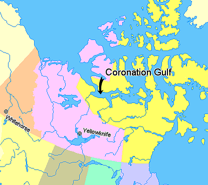
Map indicating Coronation Gulf, Nunavut, Canada.
© Her Majesty the Queen in Right of Canada, Department of Natural Resources. All rights reserved.
Licence Agreement
مۆڵەتنامە

|
The copyright holder of this work allows anyone to use it for any purpose including unrestricted redistribution, commercial use, and modification.
Usage notes:
|
مێژووی پەڕگە
کرتە بکە لەسەر یەکێک لە ڕێکەوت/کاتەکان بۆ بینینی پەڕگەکە بەو شێوەی لەو کاتەدا بووە.
| ڕێکەوت/کات | ھێما | ئەندازە | بەکارھێنەر | تێبینی | |
|---|---|---|---|---|---|
| هەنووکە | ٠٤:٠١، ٢١ی ئازاری ٢٠٠٦ | | ٤١٥ لە ٣٧٠ (٦٥ کیلۆبایت) | David Kernow~commonswiki | Map indicating Coronation Gulf, Nunavut, Canada. {{legend|#ffff66|Nunavut}} {{legend|#ffccff|Northwest Territories}} {{legend|#ffcc99|Yukon Territory}} {{legend|#ffff99|British Columbia}} {{legend|#cccc99|Alberta}} {{legend|#99ffcc| |
بەکارھێنانی پەڕگە
ئەم پەڕەیە ئەم پەڕگەیە بەکار دەھێنێت:
بەکارھێنانی سەرانسەریی پەڕگە
ئەم ویکیانەی دیکەی خوارەوەش ئەم پەڕگە بەکاردێنن:
- بەکارھێنان لە ar.wikipedia.org
- بەکارھێنان لە de.wikipedia.org
- بەکارھێنان لە en.wikipedia.org
- بەکارھێنان لە en.wiktionary.org
- بەکارھێنان لە es.wikipedia.org
- بەکارھێنان لە et.wikipedia.org
- بەکارھێنان لە fa.wikipedia.org
- بەکارھێنان لە fi.wikipedia.org
- بەکارھێنان لە fr.wikipedia.org
- بەکارھێنان لە ja.wikipedia.org
- بەکارھێنان لە ml.wikipedia.org
- بەکارھێنان لە nl.wikipedia.org