پەڕگە:LocationIndia.png

قەبارەی ئەم پێشبینینە: ٨٠٠ لە ٣٧٠ پیکسەڵ. ڕێزەلووشنەکانی تر: ٣٢٠ لە ١٤٨ پیکسەڵ | ٦٤٠ لە ٢٩٦ پیکسەڵ | ١٬٣٥٧ لە ٦٢٨ پیکسەڵ.
پەڕگەی سەرەکی (١٬٣٥٧ × ٦٢٨ پیکسڵ، قەبارەی پەڕگە: ٢١ کیلۆبایت، جۆری ئێم ئای ئێم ئی: image/png)

|
This locator map image could be re-created using vector graphics as an SVG file. This has several advantages; see Commons:Media for cleanup for more information. If an SVG form of this image is available, please upload it and afterwards replace this template with
{{vector version available|new image name}}.
It is recommended to name the SVG file “LocationIndia.svg”—then the template Vector version available (or Vva) does not need the new image name parameter. |
کورتە
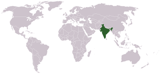
Location map for w:India.
User:dbenbenn modified Image:BlankMap-World.png.
مۆڵەتنامە
| |
ئەم بەرھەمە بەدەستی بەرھەمھێنەرەکەی Vardion, at the ئینگلیزی ویکیپیدیا project، بڵاوکراوەتەوە بۆ پاوانی گشتی (public domain). ئەم مافە بۆ سەرانسەری جیھانە. In case this is not legally possible: |
مێژووی پەڕگە
کرتە بکە لەسەر یەکێک لە ڕێکەوت/کاتەکان بۆ بینینی پەڕگەکە بەو شێوەی لەو کاتەدا بووە.
| ڕێکەوت/کات | ھێما | ئەندازە | بەکارھێنەر | تێبینی | |
|---|---|---|---|---|---|
| هەنووکە | ٠٧:٣٥، ١١ی ئەیلوولی ٢٠٢١ | | ١٬٣٥٧ لە ٦٢٨ (٢١ کیلۆبایت) | Ytpks896 | Reverted to version as of 22:39, 12 February 2005 (UTC) |
| ١٣:٣٧، ٢٩ی تەممووزی ٢٠٢١ |  | ١٬٤٢٧ لە ٦٢٨ (١٠٣ کیلۆبایت) | Ytpks896 | Reverted to version as of 03:16, 1 May 2008 (UTC) | |
| ٠٠:٣٣، ١٥ی شوباتی ٢٠١٠ |  | ١٬٣٥٧ لە ٦٢٨ (٢٤ کیلۆبایت) | King Zebu | Reverted to version as of 09:17, 3 June 2005 Please discuss before making such edits in future. | |
| ٠٣:١٦، ١ی ئایاری ٢٠٠٨ |  | ١٬٤٢٧ لە ٦٢٨ (١٠٣ کیلۆبایت) | KAVO | (Changed to colours more noticeable: *Light green - Claimed by India, not administered by India **(Aksai Chin, Azad Kashmir, Northern Areas, Shaksgam Valley) *Deep Green - Disputed with other nations, administered by India **(Arunachal Pradesh, Jammu and | |
| ٠٩:١٧، ٣ی حوزەیرانی ٢٠٠٥ |  | ١٬٣٥٧ لە ٦٢٨ (٢٤ کیلۆبایت) | Nichalp | NPOV map, please discuss any changes with me for NPOV status | |
| ٢٢:٣٩، ١٢ی شوباتی ٢٠٠٥ |  | ١٬٣٥٧ لە ٦٢٨ (٢١ کیلۆبایت) | Dbenbenn | higher resolution version, without black border | |
| ٢٠:٢٨، ٥ی کانوونی یەکەمی ٢٠٠٤ |  | ٢٥٠ لە ١١٥ (١٨ کیلۆبایت) | EugeneZelenko | Location map for India.<br/>Originally created for English Wikipedia by Vardion.<br/>{{GFDL}} |
بەکارھێنانی پەڕگە
ئەم پەڕەی 2ە ئەم پەڕگەیە بەکار دەھێنێت:
بەکارھێنانی سەرانسەریی پەڕگە
ئەم ویکیانەی دیکەی خوارەوەش ئەم پەڕگە بەکاردێنن:
- بەکارھێنان لە ar.wikinews.org
- بەکارھێنان لە en.wikipedia.org
- بەکارھێنان لە en.wikinews.org
- بەکارھێنان لە en.wikivoyage.org
- بەکارھێنان لە en.wiktionary.org
- بەکارھێنان لە fr.wikinews.org
- بەکارھێنان لە fur.wikipedia.org
- بەکارھێنان لە he.wikivoyage.org
- بەکارھێنان لە hr.wikipedia.org
- بەکارھێنان لە hr.wikiquote.org
- بەکارھێنان لە incubator.wikimedia.org
- بەکارھێنان لە ko.wikipedia.org
- بەکارھێنان لە li.wikinews.org
- بەکارھێنان لە pam.wikipedia.org
- بەکارھێنان لە pl.wiktionary.org
- بەکارھێنان لە ps.wikivoyage.org
- بەکارھێنان لە pt.wikivoyage.org
- بەکارھێنان لە pt.wiktionary.org
- بەکارھێنان لە sr.wikibooks.org
- بەکارھێنان لە sv.wikinews.org
- بەکارھێنان لە ta.wikinews.org
بینینی بەکارھێنانی گشتی زیاتری ئەم پەڕگەیە.