پەڕگە:Locatie Straat van Otranto.PNG
رەزۆلوشنی سەرتر لەمە لە بەردەست دا نیە.
Locatie_Straat_van_Otranto.PNG (٣٧٨ × ٢٣٦ پیکسڵ، قەبارەی پەڕگە: ٨ کیلۆبایت، جۆری ئێم ئای ئێم ئی: image/png)
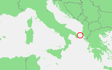
| وەسف | In dutch: Locatie Straat van Otranto.PNG | ||||
| سەرچاوە | own work based on PD map | ||||
| بەرھەمھێنەر | edited by M.Minderhoud | ||||
| ڕێپێدان (بەکارھێنانەوەی ئەم پەڕگەیە) |
|
مێژووی پەڕگە
کرتە بکە لەسەر یەکێک لە ڕێکەوت/کاتەکان بۆ بینینی پەڕگەکە بەو شێوەی لەو کاتەدا بووە.
| ڕێکەوت/کات | ھێما | ئەندازە | بەکارھێنەر | تێبینی | |
|---|---|---|---|---|---|
| هەنووکە | ٢٠:١٠، ١٩ی شوباتی ٢٠١٠ | | ٣٧٨ لە ٢٣٦ (٨ کیلۆبایت) | Telim tor | focussing on object |
| ١٨:٢١، ١٢ی ئەیلوولی ٢٠٠٦ |  | ٤٧٣ لە ٤٣٠ (١٦ کیلۆبایت) | Michiel1972 | {{Information |Description=In dutch: {{subst:PAGENAME}} |Source= own work based on PD map |Date= |Author= edited by M.Minderhoud |Permission= {{PD-Demis}} |other_versions= }} category:Locator maps of seas |
بەکارھێنانی پەڕگە
ئەم پەڕەیە ئەم پەڕگەیە بەکار دەھێنێت:
بەکارھێنانی سەرانسەریی پەڕگە
ئەم ویکیانەی دیکەی خوارەوەش ئەم پەڕگە بەکاردێنن:
- بەکارھێنان لە ar.wikipedia.org
- بەکارھێنان لە ca.wikipedia.org
- بەکارھێنان لە cy.wikipedia.org
- بەکارھێنان لە de.wikipedia.org
- بەکارھێنان لە en.wikipedia.org
- بەکارھێنان لە es.wikipedia.org
- بەکارھێنان لە fo.wikipedia.org
- بەکارھێنان لە fr.wikipedia.org
- بەکارھێنان لە fy.wikipedia.org
- بەکارھێنان لە hu.wikipedia.org
- بەکارھێنان لە nl.wikipedia.org
- بەکارھێنان لە pl.wikipedia.org
- بەکارھێنان لە pl.wiktionary.org
- بەکارھێنان لە pt.wikipedia.org
- بەکارھێنان لە tr.wikipedia.org
- بەکارھێنان لە vls.wikipedia.org