پەڕگە:Jomann Imperium Periscum.jpg

قەبارەی ئەم پێشبینینە: ٧٠٣ لە ٦٠٠ پیکسەڵ. ڕێزەلووشنەکانی تر: ٢٨١ لە ٢٤٠ پیکسەڵ | ٥٦٣ لە ٤٨٠ پیکسەڵ | ٩٠٠ لە ٧٦٨ پیکسەڵ | ١٬٢٠٠ لە ١٬٠٢٤ پیکسەڵ | ١٬٩٩٢ لە ١٬٧٠٠ پیکسەڵ.
پەڕگەی سەرەکی (١٬٩٩٢ × ١٬٧٠٠ پیکسڵ، قەبارەی پەڕگە: ٢٫١٨ مێگابایت، جۆری ئێم ئای ئێم ئی: image/jpeg)
کورتە
| وەسف |
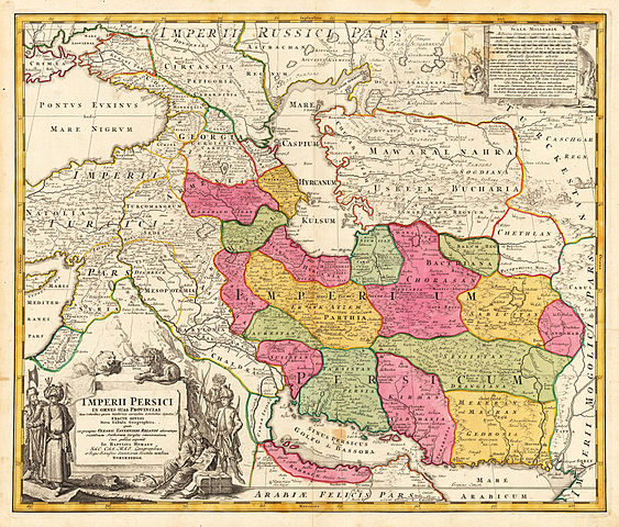
English: Map of Persia Copperplate print on paper, colorized, 53 × 60.7 cm |
|||||||||||||||||||||||
| ڕێکەوت | لە بەنزیکی ١٧٠٠ تاوەکوو بەنزیکی ١٧٢٠ | |||||||||||||||||||||||
| سەرچاوە | www.lot-tissimo.net | |||||||||||||||||||||||
| بەرھەمھێنەر |
|
|||||||||||||||||||||||
| وەشانەکانی تر | ||||||||||||||||||||||||
.jpg)


مۆڵەتنامە
|
This is a faithful photographic reproduction of a two-dimensional, public domain work of art. The work of art itself is in the public domain for the following reason:
The official position taken by the Wikimedia Foundation is that "faithful reproductions of two-dimensional public domain works of art are public domain".
This photographic reproduction is therefore also considered to be in the public domain in the United States. In other jurisdictions, re-use of this content may be restricted; see Reuse of PD-Art photographs for details. | ||||
مێژووی پەڕگە
کرتە بکە لەسەر یەکێک لە ڕێکەوت/کاتەکان بۆ بینینی پەڕگەکە بەو شێوەی لەو کاتەدا بووە.
| ڕێکەوت/کات | ھێما | ئەندازە | بەکارھێنەر | تێبینی | |
|---|---|---|---|---|---|
| هەنووکە | ٢١:٥٠، ١٦ی تشرینی دووەمی ٢٠١٥ | | ١٬٩٩٢ لە ١٬٧٠٠ (٢٫١٨ مێگابایت) | Taron Saharyan | в лучшем качестве |
| ٢٢:١٤، ١٩ی ئەیلوولی ٢٠١٠ |  | ٧٦٨ لە ٦٤٨ (٣٨٦ کیلۆبایت) | Geagea | Reverted to version as of 22:42, 13 February 2006 | |
| ٢٢:١٣، ١٩ی ئەیلوولی ٢٠١٠ |  | ٦٥٠ لە ٥٧٢ (١٩٤ کیلۆبایت) | Geagea | new | |
| ٢٢:٤٢، ١٣ی شوباتی ٢٠٠٦ |  | ٧٦٨ لە ٦٤٨ (٣٨٦ کیلۆبایت) | AndreasPraefcke | Johann Baptista Homann (1644–1724): Map of Persia, c. 1700 Copperplate print on paper, colorized, 53 × 60.7 cm {{PD-art}} Source: http://www.lot-tissimo.net/ Category:Historical Maps of Asia Category:Maps of Iran |
بەکارھێنانی پەڕگە
ئەم پەڕەی 4ە ئەم پەڕگەیە بەکار دەھێنێت:
بەکارھێنانی سەرانسەریی پەڕگە
ئەم ویکیانەی دیکەی خوارەوەش ئەم پەڕگە بەکاردێنن:
- بەکارھێنان لە ace.wikipedia.org
- بەکارھێنان لە ba.wikipedia.org
- بەکارھێنان لە bs.wikipedia.org
- بەکارھێنان لە cs.wikipedia.org
- بەکارھێنان لە de.wikipedia.org
- بەکارھێنان لە en.wikipedia.org
- Sistan
- Talk:Safavid dynasty/Archive 10
- User:Khodabandeh14/On Safavid Article
- User:Khodabandeh14/Safavids/OfficalNameOrigin
- User talk:Khodabandeh14/Safavids/OfficalNameOrigin
- Talk:Safavid dynasty/Archive 12
- Talk:Safavid dynasty/Archive 13
- Don–Volga portage
- User:Falcaorib
- Shahr-i Gholghola
- Template:Sistan
- Trakhun
- بەکارھێنان لە es.wikipedia.org
- بەکارھێنان لە fa.wikipedia.org
- بەکارھێنان لە fa.wikibooks.org
- بەکارھێنان لە hr.wikipedia.org
- بەکارھێنان لە hy.wikipedia.org
- بەکارھێنان لە id.wikipedia.org
- بەکارھێنان لە incubator.wikimedia.org
- بەکارھێنان لە ja.wikipedia.org
- بەکارھێنان لە ka.wikipedia.org
- بەکارھێنان لە mr.wikipedia.org
- بەکارھێنان لە mzn.wikipedia.org
- بەکارھێنان لە ru.wikipedia.org
بینینی بەکارھێنانی گشتی زیاتری ئەم پەڕگەیە.