پەڕگە:Djibouti relief location map.jpg

قەبارەی ئەم پێشبینینە: ٥٩٩ لە ٦٠٠ پیکسەڵ. ڕێزەلووشنەکانی تر: ٢٤٠ لە ٢٤٠ پیکسەڵ | ٤٧٩ لە ٤٨٠ پیکسەڵ | ٧٦٧ لە ٧٦٨ پیکسەڵ | ١٬٠٢٣ لە ١٬٠٢٤ پیکسەڵ | ١٬٥٤٠ لە ١٬٥٤٢ پیکسەڵ.
پەڕگەی سەرەکی (١٬٥٤٠ × ١٬٥٤٢ پیکسڵ، قەبارەی پەڕگە: ١٫٢٦ مێگابایت، جۆری ئێم ئای ئێم ئی: image/jpeg)
| وەسف |
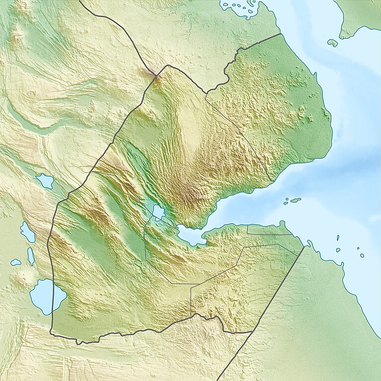
Deutsch: Physische Positionskarte von Dschibuti
Quadratische Plattkarte. Geographische Begrenzung der Karte:
English: Physical location map of Djibouti
Equirectangular projection. Geographic limits of the map:
|
| ڕێکەوت | |
| سەرچاوە | بەرھەمی خۆم, using map data from administrative map by NordNordWest. The relief was created from SRTM-3 relief data |
| بەرھەمھێنەر | Carport |
| ڕێپێدان (بەکارھێنانەوەی ئەم پەڕگەیە) |
ئەم پەڕگەیە لە ژێر مۆڵەتنامەی
Creative Commons Attribution-Share Alike 3.0 Unported دایە.
|
| وەشانەکانی تر |
|

مێژووی پەڕگە
کرتە بکە لەسەر یەکێک لە ڕێکەوت/کاتەکان بۆ بینینی پەڕگەکە بەو شێوەی لەو کاتەدا بووە.
| ڕێکەوت/کات | ھێما | ئەندازە | بەکارھێنەر | تێبینی | |
|---|---|---|---|---|---|
| هەنووکە | ٠٨:٥٣، ١٧ی نیسانی ٢٠١٠ | | ١٬٥٤٠ لە ١٬٥٤٢ (١٫٢٦ مێگابایت) | Carport | {{Information |Description={{de|Physische Positionskarte von {{w|Dschibuti|3=de}}}} Quadratische Plattkarte. Geographische Begrenzung der Karte: * N: 12.9° N * S: 10.7° N * W: 41.5° O * O: 43.7° O {{en|Physical location map of {{w|Djibouti}}}} Equirec |
بەکارھێنانی پەڕگە
ئەم پەڕەیە ئەم پەڕگەیە بەکار دەھێنێت:
بەکارھێنانی سەرانسەریی پەڕگە
ئەم ویکیانەی دیکەی خوارەوەش ئەم پەڕگە بەکاردێنن:
- بەکارھێنان لە ar.wikipedia.org
- بەکارھێنان لە ast.wikipedia.org
- بەکارھێنان لە az.wikipedia.org
- بەکارھێنان لە ba.wikipedia.org
- بەکارھێنان لە be.wikipedia.org
- بەکارھێنان لە bg.wikipedia.org
- بەکارھێنان لە bn.wikipedia.org
- بەکارھێنان لە bs.wikipedia.org
- بەکارھێنان لە ceb.wikipedia.org
- بەکارھێنان لە ce.wikipedia.org
- بەکارھێنان لە cs.wikipedia.org
- بەکارھێنان لە da.wikipedia.org
- بەکارھێنان لە de.wikipedia.org
- Dschibuti
- Assalsee (Dschibuti)
- Abbe-See
- Arta (Dschibuti)
- Golf von Tadjoura
- Vorlage:Positionskarte Dschibuti
- Wikipedia:Kartenwerkstatt/Positionskarten/Afrika
- Ardoukoba
- Benutzer:Carport/Galerie
- Holhol
- Ali Adde
- Loyada
- Goda-Massiv
- Mousa Alli
- Doumeira
- Musha (Insel)
- Sawabi-Inseln
- Oueah
- Ghoubbet-el-Kharab
- Damerjog
- Musha-Inseln
- Maskal
- Île du Large (Dschibuti)
بینینی بەکارھێنانی گشتی زیاتری ئەم پەڕگەیە.