پەڕگە:Norfolk UK locator map 2010.svg

Size of this PNG preview of this SVG file: ٤٩٤ لە ٦٠٠ پیکسەڵ. ڕێزەلووشنەکانی تر: ١٩٨ لە ٢٤٠ پیکسەڵ | ٣٩٥ لە ٤٨٠ پیکسەڵ | ٦٣٣ لە ٧٦٨ پیکسەڵ | ٨٤٣ لە ١٬٠٢٤ پیکسەڵ | ١٬٦٨٧ لە ٢٬٠٤٨ پیکسەڵ | ١٬١٠٨ لە ١٬٣٤٥ پیکسەڵ.
پەڕگەی سەرەکی (پەڕگەی SVG، بە ناو ١٬١٠٨ × ١٬٣٤٥ پیکسەڵ، قەبارەی پەڕگە: ٣٠٢ کیلۆبایت)
کورتە
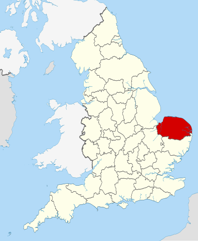
| وەسف | Location of the ceremonial county of Norfolk within England. |
| ڕێکەوت | |
| سەرچاوە |
National Geospatial-Intelligence Agency
|
| بەرھەمھێنەر | Nilfanion |
مۆڵەتنامە
من، ھەڵگری مافی لەبەرگرتنەوەی ئەم بەرھەمە، لەژێر ئەم مۆڵەتنامەیانەدا بڵاوی دەکەمەوە:
ئەم پەڕگەیە لە ژێر مۆڵەتنامەی
Creative Commons Attribution-Share Alike 3.0 Unported دایە.
- تۆ ئازادی:
- بۆ بڵاکردنەوە – بۆ کۆپی کردن، دابەشکردن و دەستبەدەست ناردنی
- بۆ تێکەڵکردنەوە – بۆ سازاندنی کارەکە
- بەم مەرجانەی خوارەوە:
- دانەپاڵ – پێویستە باوەڕی گونجاو بدەیت، بەستەرێک بۆ مۆڵەتەکە دابین بکەیت و ئاماژە بەوە بکەیت کە ئایا گۆڕانکاری کراوە یان نا. دەتوانیت بە هەر شێوەیەکی گونجاو ئەوە بکەیت، بەڵام بە شێوەیەک نا کە وا دەربکەوێت کە مۆڵەتدەر پشتگیری تۆ یان بەکارهێنانەکەت بکات.
- بڵاوکردنەوەی گونجاو – ئەگەر لەسەر بنەمای ئەم کارە تێکەڵ، گۆڕان، یان ساز بکەی، پێویستە بەشدارییەکانت بە هەمان مۆڵەت یان هاوشێوەی مۆڵەتی ئەسڵی دابەش بکەی.

|
ڕێگەدراوە بە لەبەرگرتنەوە، دابەشکردن ھەروەھا/یان سازاندنی ئەم بەڵگەنامەیە لەژێر مەرجی مۆڵەتی GNU بۆ بەڵگەنامەی ئازاد، وەشانی ١.٢ یان ھەر وەشانێکی تری دواتر کە بڵاوکراوەتەوە لەلایەن دامەزراوەی بەرنامەی ئازاد، بەبێ ھیچ بەشێکی جیاواز، بەبێ نووسین لەسەر بەرگی پێشەوە و دواوەی. وێنەیەک لەمۆڵەتەکە لە بەشێکدا ھەیە کە ناوی مۆڵەتی GNU بۆ بەڵگەنامەی ئازادە. |
دەتوانی مۆڵەتنامەی دڵخوازت ھەڵبژێریت.

|
This is one of the images forming part of the Valued image set: Locator maps of the Ceremonial counties of England on Wikimedia Commons. The image set has been assessed under the valued image set criteria and is considered the most valued set on Commons within the scope:
Locator maps of the Ceremonial counties of England
You can see its nomination at Commons:Valued image candidates/Locator maps of English ceremonial counties. |
مێژووی پەڕگە
کرتە بکە لەسەر یەکێک لە ڕێکەوت/کاتەکان بۆ بینینی پەڕگەکە بەو شێوەی لەو کاتەدا بووە.
| ڕێکەوت/کات | ھێما | ئەندازە | بەکارھێنەر | تێبینی | |
|---|---|---|---|---|---|
| هەنووکە | ٢٢:٤٠، ٢٣ی تشرینی دووەمی ٢٠١٠ | | ١٬١٠٨ لە ١٬٣٤٥ (٣٠٢ کیلۆبایت) | Nilfanion | == Summary == {{Information |Description=Location of the ceremonial county of Norfolk within England. |Source=Ordnance Survey [https://www.ordnancesurvey.co.uk/opendatadownload/products.html OpenData]: *County boundarie |
بەکارھێنانی پەڕگە
ئەم پەڕەیە ئەم پەڕگەیە بەکار دەھێنێت:
بەکارھێنانی سەرانسەریی پەڕگە
ئەم ویکیانەی دیکەی خوارەوەش ئەم پەڕگە بەکاردێنن:
- بەکارھێنان لە af.wikipedia.org
- بەکارھێنان لە ar.wikipedia.org
- بەکارھێنان لە ast.wikipedia.org
- بەکارھێنان لە az.wikipedia.org
- بەکارھێنان لە be-tarask.wikipedia.org
- بەکارھێنان لە bg.wikipedia.org
- بەکارھێنان لە br.wikipedia.org
- بەکارھێنان لە ca.wikipedia.org
- بەکارھێنان لە ceb.wikipedia.org
- بەکارھێنان لە cs.wikipedia.org
- بەکارھێنان لە da.wikipedia.org
- بەکارھێنان لە en.wikipedia.org
- Norfolk
- Ranworth
- Reedham, Norfolk
- Wayford Bridge
- Neatishead
- South Walsham
- Malthouse Broad
- Upton Fen
- Hoveton Great Broad
- Wroxham Broad
- St Olaves
- Halvergate
- Crome's Broad
- Salhouse Broad
- Mid-Yare National Nature Reserve
- Upton, Norfolk
- Weavers' Way
- Bure Valley Path
- Irstead
- Ludham Bridge
- Sandringham, Norfolk
- River Chet
- Beeston, Norfolk
- Crown Point, Norwich
- Bradwell, Norfolk
- Arminghall
- Bacton, Norfolk
- Shelfanger
- West Dereham
- Scoulton
- Morston
- Swardeston
- Norfolk Burnhams
- Trunch
- Oxwick
- Shereford
- Carleton Rode
بینینی بەکارھێنانی گشتی زیاتری ئەم پەڕگەیە.