پەڕگە:Anguilla location map.svg

Size of this PNG preview of this SVG file: ٦٦٤ لە ٥٩٩ پیکسەڵ. ڕێزەلووشنەکانی تر: ٢٦٦ لە ٢٤٠ پیکسەڵ | ٥٣٢ لە ٤٨٠ پیکسەڵ | ٨٥١ لە ٧٦٨ پیکسەڵ | ١٬١٣٤ لە ١٬٠٢٤ پیکسەڵ | ٢٬٢٦٩ لە ٢٬٠٤٨ پیکسەڵ | ١٬٧٧٧ لە ١٬٦٠٤ پیکسەڵ.
پەڕگەی سەرەکی (پەڕگەی SVG، بە ناو ١٬٧٧٧ × ١٬٦٠٤ پیکسەڵ، قەبارەی پەڕگە: ٥٦ کیلۆبایت)
کورتە
| وەسف |
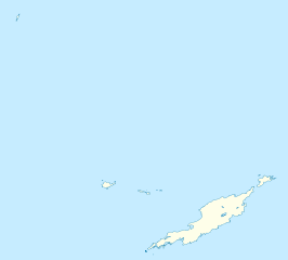
Deutsch: Positionskarte von Anguilla
Geographische Begrenzung der Karte:
English: Location map of Anguilla
Geographic limits of the map:
|
||||||||||||
| ڕێکەوت | |||||||||||||
| سەرچاوە | بەرھەمی خۆم | ||||||||||||
| بەرھەمھێنەر | NordNordWest | ||||||||||||
| ڕێپێدان (بەکارھێنانەوەی ئەم پەڕگەیە) |
|
||||||||||||
| وەشانەکانی تر | Derivative works of this file: Anguilla islands.svg |

|
This map has been made or improved in the German Kartenwerkstatt (Map Lab). You can propose maps to improve as well.
|
مێژووی پەڕگە
کرتە بکە لەسەر یەکێک لە ڕێکەوت/کاتەکان بۆ بینینی پەڕگەکە بەو شێوەی لەو کاتەدا بووە.
| ڕێکەوت/کات | ھێما | ئەندازە | بەکارھێنەر | تێبینی | |
|---|---|---|---|---|---|
| هەنووکە | ١٨:٣٤، ٣ی ئایاری ٢٠١٠ | | ١٬٧٧٧ لە ١٬٦٠٤ (٥٦ کیلۆبایت) | NordNordWest | == {{int:filedesc}} == {{Information |Description= {{de|Positionskarte von Anguilla}} Geographische Begrenzung der Karte: * N: 18.62° N * S: 18.14° N * W: 63.46° W * O: 62.90° W {{en|Location map of Anguilla}} Geograp |
بەکارھێنانی پەڕگە
ئەم پەڕەیە ئەم پەڕگەیە بەکار دەھێنێت:
بەکارھێنانی سەرانسەریی پەڕگە
ئەم ویکیانەی دیکەی خوارەوەش ئەم پەڕگە بەکاردێنن:
- بەکارھێنان لە af.wikipedia.org
- بەکارھێنان لە an.wikipedia.org
- بەکارھێنان لە ar.wikipedia.org
- بەکارھێنان لە ast.wikipedia.org
- بەکارھێنان لە ba.wikipedia.org
- بەکارھێنان لە be.wikipedia.org
- بەکارھێنان لە bg.wikipedia.org
- بەکارھێنان لە bs.wikipedia.org
- بەکارھێنان لە ceb.wikipedia.org
- Anguilla
- Gumagamit:Lsj/Test
- Plantilya:Location map United Kingdom Anguilla
- Sandy Island
- Long Bay
- Great Bay
- Shoal Bay
- West Point
- West Cay
- Sandy Point
- Long Rock
- Little Island
- Blowing Rock
- Windward Point
- Warner Point
- The Valley
- Valley
- Stoney Bay
- Spring Bay
- Sombrero (pagklaro)
- Hat Island
- Sombrero Island
- Snake Point
- Lovers Point
- Seal Rocks
- Seal Island
- Seal Islets
- Seal Islands
- Scrub Island
- Scrub Islet
- Savannah Bay
- Sand Island
- Sandy Hill Bay
- Road Point
- Road Bay
- North Side
بینینی بەکارھێنانی گشتی زیاتری ئەم پەڕگەیە.